Seamless integration bringing advanced aerial analytics directly into your John Deere Operations Center workflow.
FieldAgent™
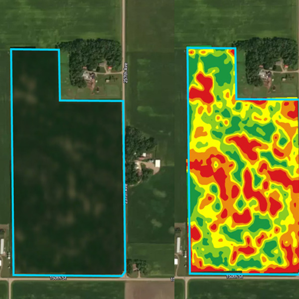
Turn imagery into actionable insights.
Make better field decisions, from emergence to harvest.
FieldAgent™ gives you field-wide visibility before you make the call. Know what’s happening in your fields from day one. Catch stand issues, health trends, and variability early — so you focus on the right acres and never second-guess your next move.
High-resolution aerial imagery provides a clear view across every acre, at a scale ground scouting along cannot cover.
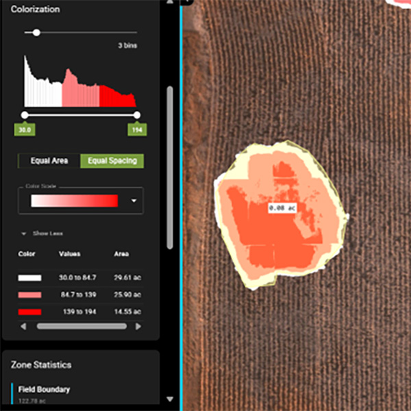
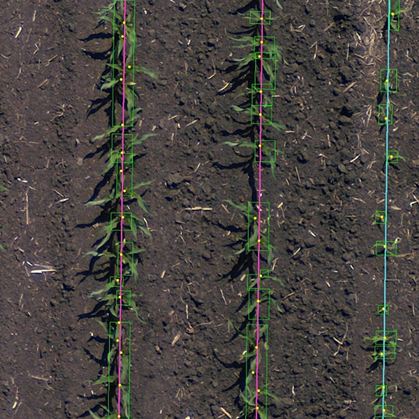
- Quantify stand counts, spacing, and emergence uniformity early to support replant decisions, and planter performance evaluations.
- Track crop health and stress patterns across the season to optimize input timing and placement actions
- Map field variability, weed pressure, and elevation patterns to guide scouting, input planning, and in-season adjustments

How it Works
From Imagery to Insight
FieldAgent simplifies your workflow from field to decision in three easy steps.
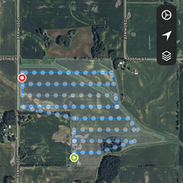
Plan and Fly
Let FieldAgent optimize your drone missions, automatically capture perfect imagery with the most popular drones and Sentera sensors ensure data capture success.
Upload Imagery
Upload imagery to FieldAgent, analytics are processed automatically based on your planned goals, like stand counts, canopy cover, or crop health.
Analyze and Review
View and share visual maps, analytics, and reports that reveal performance, variability, and trends — ready to inform your next move.
A Seamless Workflow
From drone flight to decision, everything happens end-to-end in one connected platform—fast, visual, and built for better agronomic intelligence.
Field Intelligence meets field execution.
Connect FieldAgent to John Deere Operations Center so imagery-based visualizations and insights sit alongside the operational data your team already trusts. Whether it’s a replant decision, a spray call, or a mid-season adjustment, you are acting on data, not assumptions. That means less duplicate setup, cleaner overlays with planting and application records, and a faster path from what you saw to what you do next.
Better together with Operations Center.
Your fields are ready from day one.
Easily sync field boundaries, so there’s no re-drawing or duplicate setup.
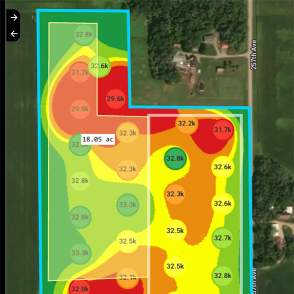
Generate prescriptions from scouting data.
Turn emergence and crop health insights into variable-rate prescriptions and push directly to Operations Center.
Compare machine and scouting data.
Push scouting data to Operations Center to view scouting and machine data together in FieldAnalyzer.
SMARTSCRIPT™ Weeds:
Fly today. Prescription in Operations Center by tomorrow morning.

SMARTSCRIPT™ Weeds turns high-resolution drone imagery into targeted post-emergence and burndown herbicide prescriptions by 6 AM the following day. Weed pressure is identified and mapped across the field, so you can prioritize acres, plan tank mixes, and send the sprayer with greater confidence.
The prescription arrives in Operations Center as a Work Plan, ready for review and deployment to an ExactApply-enabled sprayer.
Analytics Access by License
• Drone Flight Planning
• Ground Scouting
• Satellite Imagery Layers
• Measurement & Analysis
• Report Creation
• Field Sharing
• Platform Integrations
Agronomic measurement, connected to execution.
Measure and analyze in FieldAgent. Align and execute in Operations Center.