


SENTERA SENSORS & DRONES
High performance aerial hardware
delivering accurate insights.
OUR SOLUTIONS
Mission, Accomplished with Proven Technology

Award-winning sensor technology
RGB, multispectral, and thermal sensors designed for precise aerial intelligence.
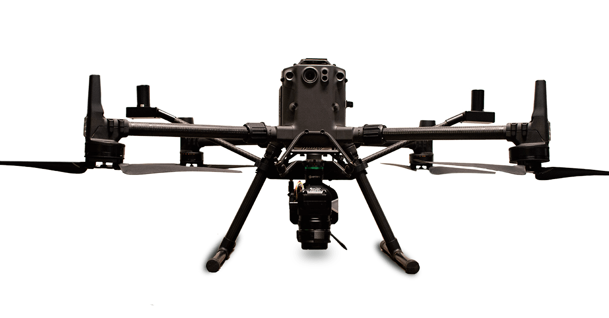
Drone Systems for your needs
Choose the drone system for your use case. Or, let us help you build one to your exact requirements.


Fast data processing tools
Orthomosaics and agronomic insights to deliver detailed insights for analysis.
See the specs for your ideal hardware solution
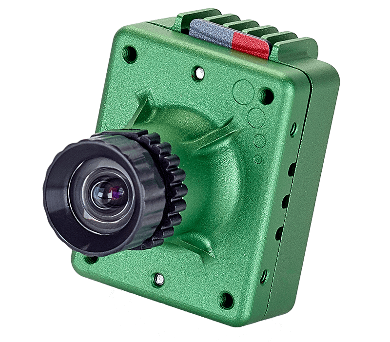
Single Sensor
Capture more accurate NDVI and NDRE indices
GSD: 2.2″ (5.5cm) at 200′
Capture Rate: 15 fps (1.2MP stills)
Drone Compatibility: DJI Mavic 2 Pro and DJI Phantom 4 Pro
65R
Ultra-high-resolution aerial imagery
GSD: 0.3cm at 125′
Capture Rate: 3 fps
Drone Compatibility: DJI Matrice Series, Freefly Astro, Sentera PHX
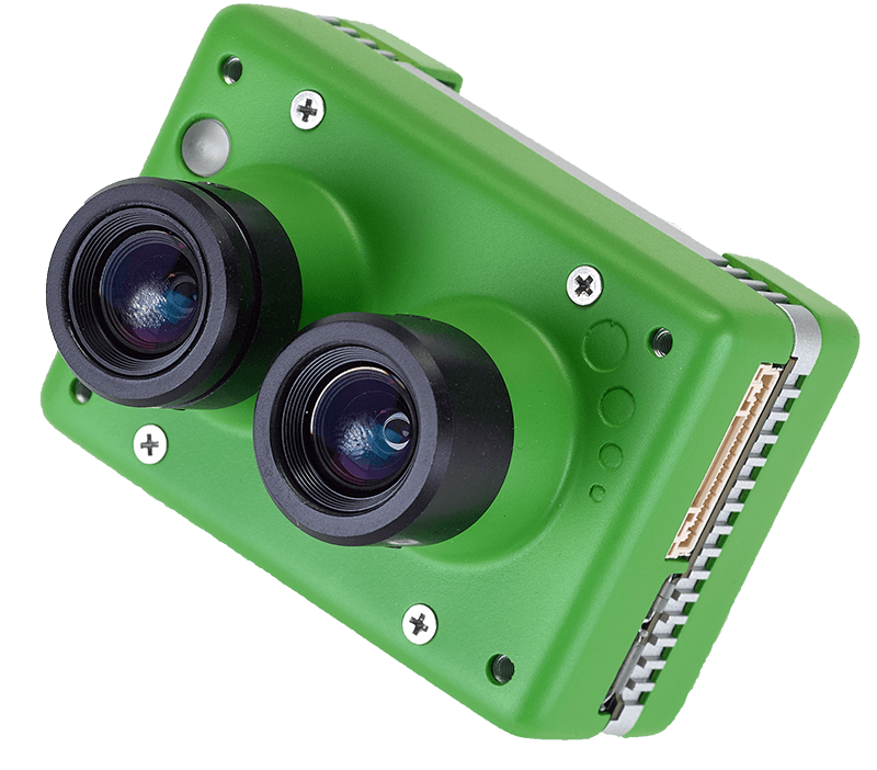
Double 4K
The most versatile sensor for RGB & multispectral imagery
GSD: 0.69″ (1.8 cm) at 200′
Capture Rate: 2 fps (12.3MP stills)
Drone Compatibility: DJI Inspire Series, DJI Matrice Series, DJI Mavic Series, DJI Phantom 4 Pro
DGR System
Never stitch a mosaic again.
Capture and analyze data faster 5x faster with a drone accessory designed for absolute location certainty, reducing image overalp by 70%.
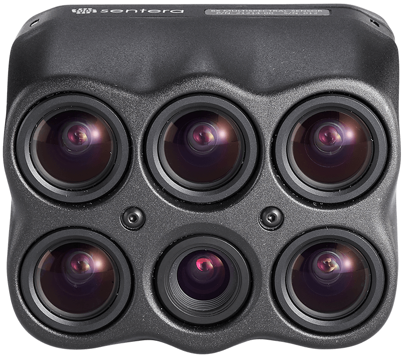
6X Multispectral & Thermal
Science-grade multispectral imagery with high radiometric accuracy
GSD: 1.0″ (2.6cm) at 200′
Capture Rate: 5 fps
Drone Compatibility: DJI Matrice Series, Freefly Astro
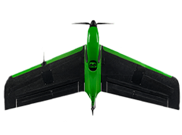
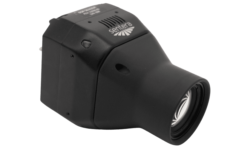
PHX
Scout faster with full field coverage
Cover more acres faster to get data to fuel in-season critical decisions for crop production.
Capturing actionable aerial insights for experts in

Agriculture

Government & Defense

Research & Education

Construction

Environmental Monitoring

Surveying & Mapping

Forestry

Public Safety

Utilities & Engineering
Hear From Our Customers
"Once you use an ag drone system to capture data throughout the season, you won't go back. From knowing where you need to replant or whether you need to go spray, the insight you get from the aerial imagery helps identify priorities to maximize yield -- which is what matters most at the end of the day."

Erich Eller
President, ForeFront Ag Solutions
"We directly compared to competitors and the Sentera 6X Sensor was the clear choice. The dedicated 20MP RGB camera is critical to our operation; and with the fast capture rate, I can fly fields at 200 feet."

Adrian Rivard
President, Drone Spray Canada, Inc.
“By using the Double 4K Sensor from Sentera, we were able to showcase treatment effects using multispectral indices to demonstrate product benefits and educate our customers on the benefits we were seeing.”

Chris Leon
Regional Technical Services Manager, FMC
Your Expertise, Our Technology.
Let's build a data-driven solution to validate outcomes.