Resources
Resources
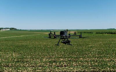
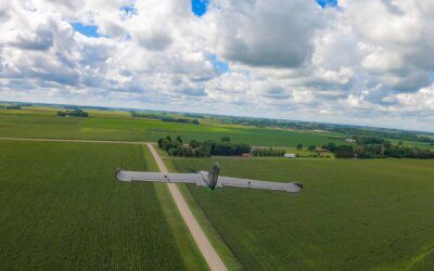
PixelScout™: Precision Imagery That Powers Smarter Spraying
In the rapidly evolving world of precision agriculture, timing, accuracy, and productivity are not optional—they are critical. That’s where PixelScout™ delivers. Designed by...

John Deere Acquires Sentera to Integrate Aerial Field Scouting
MOLINE, Illinois (May 23, 2025) — John Deere (NYSE: DE) announced today the acquisition of Sentera, a leading provider of remote imagery solutions for agriculture headquartered...
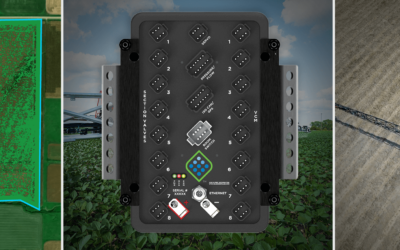
Unlocking the Power of Precision: How Sentera and Capstan Ag Are Transforming Targeted Weed Control
By Andrew Muehlfeld, Sentera & Brian Finstrom, Capstan Ag Where Precision Meets ActionIn a market full of incremental improvements, Sentera and Capstan Ag are taking a giant...
Sentera Announces Oversubscribed 2025 Early Access Program for SMARTSCRIPT™ Weeds
FOR IMMEDIATE RELEASE MINNEAPOLIS, MN — April 17, 2025 — Sentera, a leader in image-based precision agriculture solutions, today announced that its 2025 Early Access Program...
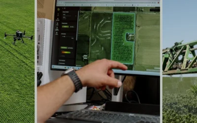
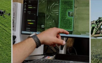
Faster Insights, Smarter Decisions: How Sentera’s Hybrid Processing Model Delivers Real-Time Value
In precision agriculture, data is everything. Drones equipped with high-resolution sensors provide powerful insights into stand counts, crop health, weed pressure, and pest...
Sentera Unveils SMARTSCRIPT™ Weeds, Formerly Aerial WeedScout, with Enhanced Features for 2025
Minneapolis, MN – January 16, 2025 – Sentera, a leader in scalable precision agriculture solutions, today announced key updates to its Aerial WeedScout platform, including a...
Driving Agriculture Efficiency with Drone-Based Remote Sensing: How Sentera is Leading the Charge Part 2 of 2
November 17, 2024 In Part 1 of this series, we explored how remote sensing is transforming agricultural efficiency by providing farmers and their advisors with real-time,...

Sentera Names Agriculture Veteran Joe Walsh as Chief Growth Officer to Drive Strategic Expansion in Precision Agriculture
MINNEAPOLIS, MN (October 16, 2024) Sentera, a leading innovator in scalable precision agriculture solutions, announced today that Joe Walsh will join the company as its Chief...

Weeding Out Herbicide Inefficiency with Sentera
EPISODE: 17Sentera’s CEO Brian Wenngatz and CTO Eric Taipale take us through their journey to launching SmartScript™ Weeds, which enables the rapid detection of weeds so farmers...

Sentera Launches Precision Weed Management Solution
June 28, 2024By Noah Newman Precision ag startup Sentera launched an Early Access Program to preview its SmartScript™ Weeds product. The company says the program will provide...

How Sentera is Redefining Field Monitoring with Remote Sensing (Part 1 of 2)
In today’s fast-paced agricultural landscape, farmers and their advisors are constantly searching for more efficient ways to monitor field conditions and boost productivity....

Ahead of the Curve
There’s new smart spray technology from precision ag startup Sentera that could lower herbicide usage by up to 70%.July 9, 2024By Noah Newman It’s called SmartScript™ Weeds. It...
The next-generation targeted spray solution overcoming on-machine sensing challenges
SmartScript™ Weeds by Sentera uses drones for targeted herbicide prescriptions, cutting costs by up to 70% and offering quick ROI.August 15, 20243 Min Read Farmers today are...
Early Access Program Success Sets Foundation for the Future of Precision Weed Management
June 6, 2024 As harvest season approaches, it is the perfect time to reflect on the growing season and share exciting updates on Sentera’s next-generation SmartScript™ Weeds...
Sentera Drone and Sensor Business Segment Moving to New Internet Domain
We are thrilled to announce that the Sentera business segment responsible for our cutting-edge drones and sensors will transition to a new internet domain: senterasensors.com.

Sentera Announces Collaboration with Leading Agribusiness Companies to Preview Transformative Weed Management Technologies for Farmers
We are thrilled to announce that the Sentera business segment responsible for our cutting-edge drones and sensors will transition to a new internet domain: senterasensors.com.

Sentera Announces Two New Board Appointments
Sentera today announced the appointment of Michael Stern and Anthony Osborne to key advisory and director roles on its Board of Directors, respectively.

The Plight of the Product Lead Using Drone Imagery and Machine Learning
How can you accelerate production of training data for AI projects in agriculture using synthetic data? What’s the difference between 2D and 3D synthetic data? Check out our blog post for a deep dive into synthetic data enabling AI for agriculture.

Estimating Biomass with Remote Sensing
Estimating biomass with remote sensing provides an efficient and effective way to better understand crop biomass at different spatial scales. Learn more in our blog post.

Enhancing Crop Research with Drone-Based Agricultural Analytics: Next Steps after Plot Stand Count Results
Stand count technology has advanced to more accurately & efficiently capture crop emergence to boost productivity – but what are the next steps after capturing stand count?

Not All Data is Created Equal: Selecting the Right Image Datasets for Precision Agriculture Applications
Not all data is created equal, determining which are the right image datasets for your precision ag applications is crucial in success.

Pushing the Limits of Spot Spray Weed Control Programs
To promote a more eco-friendly and cost-efficient approach for weed control, spot spraying has evolved for more precise herbicide application.

Ask the Expert: Why GIS is the Foundation for Accurate Ag Analytics
As Geographic Information Systems (GIS) has evolved, GIS in agriculture has become more beneficial and common.
Sentera’s Spot Scout Technology Awarded Patent
Sentera has received a patent for its Spot Scout Technology, which is at the core of its ag data that it delivers to agronomic leaders, like Stand Count, Tassel Count, and Weed Spray Prescription.

Sentera Announces Appointment of Brian Wenngatz as Chief Executive Officer
The Sentera team today announced the appointment of a new CEO. Brian Wenngatz will be joining the team.