Not all drones are created equal. This can be the most challenging aspect of building out a drone program, especially when it comes to using drones for mapping in agriculture.
Battery life, positional accuracy, and sensor capabilities are a few considerations that impact whether drones work for mapping. Selecting drones for mapping with capabilities that align with your goals is going to improve surveying. While some drones capture data up to 90% faster than manual methods, that really depends on whether or not they were designed to do so.
When drones aren’t built for easy sensor integration, there will be difficulties in finding compatible sensors, as well as being able to fly the drone at speeds that help to accelerate the data capture process. And same goes for sensors and cameras; when they are not built for drone integration, they can hurt the overall data capture process by making it longer or more difficult.
When digging into which drones you should be using for mapping, there are a couple questions to explore before pinning down the ideal system for you.
What Are the Goals You Are Trying to Accomplish?
Staying up-to-date with the latest and greatest technology can be exciting. In the world of drones for mapping, this often isn’t where one should start.
Understanding what the end data product that you are looking for will ensure you are choosing the best tools for getting the job done. The needs and wants of your operation and the data you are looking for help to set the bar for picking the most suitable drone system.
Within the agricultural industry, this encompasses a few different areas. For some, a drone serves as a great method to get an aerial view of a field or plot area – simply taking some snapshots from the air that can be reviewed to gather insights.
However, with an advanced data science ecosystem built on machine learning capabilities, this can be taken much further to get deep insights into what’s happening within the field. Getting accurate plant counts, identifying crop health issues, and understanding trends over time are a few areas where drone imagery can be translated into plant-level measurements for deep insight – whether for research, product development, or crop production.
What is Your Budget?
Setting financial boundaries before diving into hardware options can help navigate you to budget-friendly options. With drones ranging in different functionality, they also range in pricing according to these unique characteristics. And, unlike with other technology, the price for drones isn’t going down as the technology matures – mostly because it continues to advance with more advanced functionality and features.
Once you’ve identified your use case and end goals, pinpointing the price point assists in filtering in and out products that will work for your goals and your budget. This can be further complicated by determining which sensor may be best for your needs, too.
For instance, the Mavic 3 Multispectral boasts a camera that can be used for mapping. Integrating Sentera’s Double 4K on the Mavic 3 Enterprise can make this a comparable system that is an even better fit for agriculture because of its faster capture rate (two frames per second). This means covering twice as much acreage in the same amount of time; which results in faster flights and fewer battery changes. (Check out our video for the full breakdown.)
Integrating the Double 4K bumps up the price a bit, but it can be well worth the investment depending on the use case and end goal.
What Are the Best Drones for Mapping?
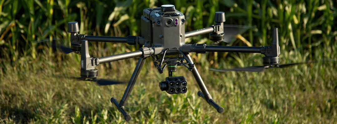
Selecting the optimal drone for your mapping needs can be determined by the needs and wants of where you’re mapping. For agriculture, the top consideration comes down to the acreage that will be flown by the drone. Covering hundreds or thousands of plots or acres can benefit from having a drone that’s built for endurance and doesn’t sacrifice image quality at higher flight speeds.
Other than the drone itself, picking the best camera or sensor is critical in putting together the most efficient and effective drone system. Sometimes, the on-board sensor may work well enough to get the data you require – but as mentioned above, there are benefits on integrating cameras that are purpose-built for capturing agricultural data. This can result in higher image quality or faster missions; both of what can be important to consider as you think about the ROI of your drone program.
Another factor to consider is how easy it is to get replacement parts, repairs, and warranties. Drone systems are an investment, and their maintenance is required for extending their lifetime. Looking for hardware that is manufactured and based in your country and area is going to ensure that you are getting faster and more accessible access to support and repair when needed. American-made drone systems can provide this accessibility in the U.S. (along with a few other benefits) that is needed for maintenance and repairs.
Pairing this with opens the door for more in-depth field or plot analysis. By taking the data captured now and in past years, you can use it to get detailed analytics to inform decisions and validate outcomes and you can use the data to identify patterns and make predictions for upcoming seasons.
 for a better look at product options for accomplishing your mapping goals.