Today, agricultural leaders face immense pressure – specifically in meeting the food demand of the growing population. Even as our world works to meet this global need, industry challenges are making crop loss more prevalent – whether it’s because of drought conditions, damage from pests and disease, or even trying to mitigate weeds in the field.
Early detection and prevention of these issues are critical in boosting productivity and minimizing crop loss. With the advent of innovative technologies and practices, key tools – like remote sensing – can help optimize yields and inform decisions that can impact end-of-season productivity.
After all, remote sensing technology has unlocked the ability for researchers, product developers, and growers to get essential data about plots and fields. In doing so, it has made it easier to access more data – whether it’s across acreage or getting more plant-level measurements and insights.
Remote Sensing for Early Detection of Crop Loss
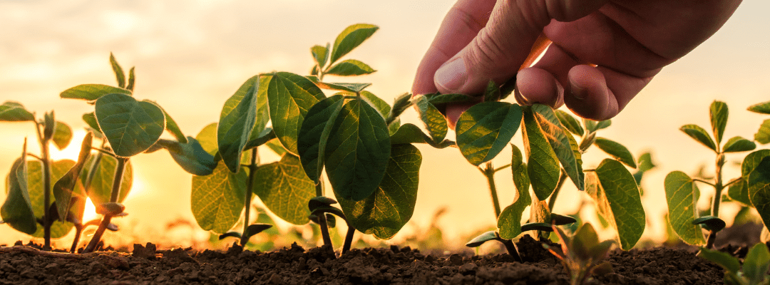
Both satellite and aerial imagery via drones and sensors provide valuable insight into crop performance and health that can give key indication into potential crop loss. Polar to traditional data collection, like boots-on-the-ground scouting, remote sensing captures more acres, faster. Remote sensing has resulted in a more convenient way to gather critical insight on what is occurring in each acre of your field.
The ability to detect changes with multispectral indices, like Normalized Difference Red Edge Index (NDRE) and Normalized Difference Vegetation Index (NDVI), provides a deeper look into the data being collected. Multispectral imagery provides insight into crop health and vigor throughout the field that would otherwise be undetectable, which helps to indicate any concerns regarding potential crop loss. Going beyond what is seen by the naked eye adds an extra component to crop loss prevention by enabling potentially more minute indicators to be detected earlier.
Early detection of crop loss indicators and factors assist in quicker decision-making – like informing the application of key inputs. The earlier adjustments are made to accommodate decline in crop health and performance, the less likely the field is susceptible to the detrimental effects of crop loss.
Remote sensing plays a role from early detection to post-crop damage assessment, providing insight into what, why, and how these factors impact overall yield and crop health. Even crop damage assessment plays a critical role in future success by both assisting in next steps and implementing measures to minimize and prevent future damage. This data helps to fuel critical decisions all season long while contributing to a more productive future with higher yields.
Beyond Crop Loss: What Does This Mean for Research & Product Development
For growers and their trusted advisors, using remote sensing techniques can be extremely beneficial to understand what’s happening in the field – and the “why” behind crop loss or other issues. But, this also unlocks essential insight for those that are working on innovations to push crop productivity to new levels.
Getting more detailed data – even as specific as what’s happening within individual plants – can help inform innovation in several key areas. For instance, as we strive to develop more sustainable agriculture practices and innovative technologies that optimize resource use, having insight into where this may be causing yield loss may offer a direction of focus.
It can help to emphasize where innovation should be prioritized. Weeds continue to be one of the toughest challenges that growers face, and because of changing dynamics within weed profiles, it requires continued advancement and innovation.
This may go beyond the chemistry and focus more on the “how” – or informing growers and their advisors on the best way to mitigate this issue and focus on crop loss prevention. This is where digital product development comes in – or technology that helps bring products to market to meet the dynamic issues that growers face today.
Within weeds, this may be changes to how and when we detect their presence in the field – by giving insight into where they are, but also which species are present. Technology can then inform which herbicide should be applied, as well as generating a prescription that focuses on targeting herbicide to specific areas in the field. And, even as the season progresses, remote sensing can be used to provide insight into how the treatment performed and whether weeds are still challenging crop growth.
What’s more, solving challenges like weeds management requires a collaborative approach. It starts with understanding what’s happening at the field level; and having a trusted advisor to support the grower in making data-driven decisions.
To do so requires a technology provider to deliver key insights and resources to help come to and implement the decision. And, at the core of this, is the product. The product that treats the problem at hand and is delivered via technology and in-person relationships to truly mitigate the issue at hand.
The Payout? A More Productive Future
Agriculture was built on the backs of rural communities, and it was because of the way that these communities supported growers that the U.S. became an agricultural powerhouse. While our world looks much different today, community still comes first. But, thanks to technology, it’s easier to build extended communities. While the idea of community may look a little different – it may be the trusted advisor with boots on the ground that can now provide recommendations based on data, thanks to remote sensing advancements.
And this can also include researchers and product developers that can use these insights to inform future innovations. Crop loss issues necessitate collaboration and knowledge sharing – and, in turn, it can encourage partnerships. This is where we can help drive crop loss prevention techniques forward. At the core of this collaboration sits technology – and the ability to help generate these insights to inform all parties and create a working partnership.
It’s often thought that the value of an eye-in-the-sky is the efficient and accurate data collected and analyzed from the whole field. While this is true, remote sensing can do so much more than that. It can ensure we are better able to inform decisions and validate outcomes that can assist in creating a more productive future.
As we move towards a more sustainable future, implementing innovative ag technologies and practices in partnership with growers, retail agronomists, and technology providers will ensure we can detect and prevent crop loss – all while building a sustainable and more productive future for all.
 .
.