Each year, the agriculture industry faces various challenges spanning from mother nature to economic disruptions. Unfortunately, the past few years have been especially riddled with problems arising from macro issues to international conflict. All of these have resulted in numerous challenges for growers around the world.
These issues have led to detrimental time and resource constraints for the agricultural industry. The labor shortage, for instance, has greatly limited available resources, making it difficult for agronomists to maintain the growing demands.
With resources dwindling and expenses piling up, learning how to leverage new precision ag technologies can help agronomists do more with less – even as the environment gets more challenging.
Field Crop Research: The Time Savings of Technology
For years, experts have been theorizing that the fourth agricultural revolution has arrived and is here to drive technology adoption. Throughout past revolutions, agriculture has advanced with the addition of heavy machinery, advanced fertilizers and pesticides, and new crop breeds.
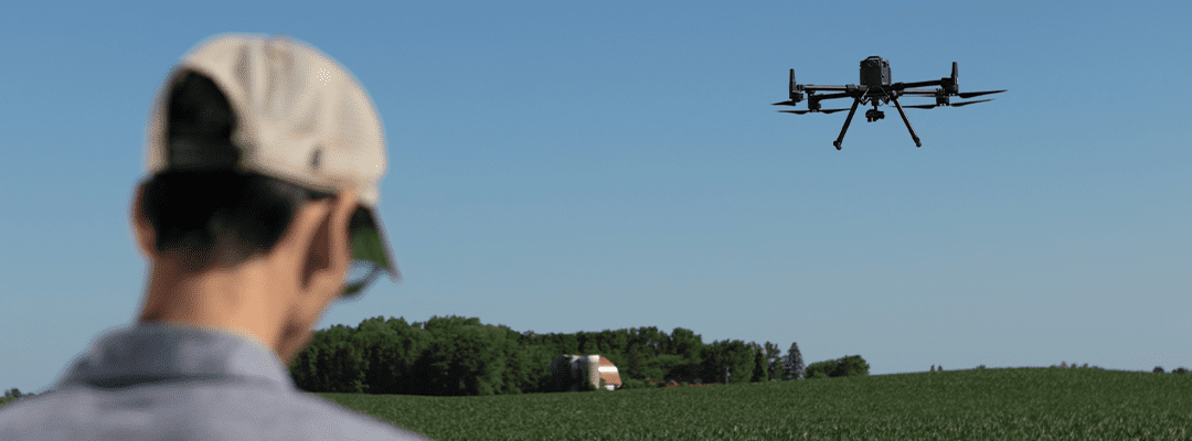
Drone technology, for instance, offers 100% aerial coverage of fields. Generating high-resolution imagery to augment boots-on-the-ground scouting activities and provide a full picture of what’s happening in the field. And it goes beyond pretty pictures. Using machine learning and artificial intelligence, these images are then translated into detailed measurements and data sets. Additionally, this gives agronomists what they’re really looking for: clear indication of performance to validate performance and outcomes throughout the season.
Leveraging ag drones and sensors to capture aerial imaging and detailed measurements, data is collected 25% faster than manual methods. Manual methods require a human to go into the field and physically count the number of plants that have emerged or measure the height to understand development. This can all be done in minutes with an ag drone, all while reducing the chance of data variability and error.
Of course, flying a drone isn’t for everyone – and for many agriscience researchers and agronomists, it can feel overwhelming to have “one more thing” on their plate. However, there are options beyond becoming a drone pilot that empowers professionals to get this valuable data.
Flight Services: We Fly for You
For agriscience and crop production leaders, Sentera’s Flight Services offers aerial drone imagery without owning, flying, or managing a drone. We do it for you. Meaning we have certified pilots around the world who are trained to fly fields, capture imagery, and send it for processing. The result? The data sets are required to power faster and more precise agronomic decisions without changing existing processes and validation points.
Our Flight Services team knows that the accuracy and precision of data matters just as much as timeliness. So, our customers choose when the team should fly and how often they should do it.
Interested in flying daily, weekly, or monthly? We can accommodate. We know that the data sets generated from high-resolution aerial imagery serve many purposes depending on what our customers are trying to accomplish. Our Flight Services team focuses on flexibility (along with an over 98% mission success) to best serve our customers.
Pilots Near You, For You
With over 250 trained pilots available in 34 states and 17 countries, our Flight Services team allows agronomists around the world to capture more data faster and power critical agronomic decisions.
A global footprint goes beyond providing resources to more people in more locations. For organizations conducting trials replicated in different geographies, meaning the same technology and processes are used. As a result, data collection variability is eliminated while getting precise and accurate measurements. Drones removing the sense of human error results in the consistent data needed for optimal results.
There is a need for problem-solving technology and services to pick up after the conflicts that agronomists face throughout the year. Flight Services provides an alternative option for companies focused on field crop research. Furthermore, this service works to decrease expenses, save time, and remove variations in data collection.
From seed production and breeding to research and product development companies, Flight Services is equipped and experienced to obtain the necessary imagery and data for successful analysis and valuable insights – all while saving time and money.
 .
.