There were 18 weather and climate disasters in 2022 that significantly impacted crop health and food production; with these disasters resulting in over $21 billion in damage – making it the third most costly disaster year in history.

From drought to wildfires to hail to flooding, the unpredictability of these events makes it even more challenging for those in agronomy. Technologies, like remote sensing, can provide some relief – helping to improve crop resilience, detect areas of stress, and even identify where damage may have occurred.
Before the Storm: Informing Crop Management Practices
While we don’t have the ability to identify and map the impact of weather and climate events on the field prior to them occurring, there are some crop management practices that can be put in place to better manage the potential impact of these events, if they should happen.
Prior to the season beginning, aerial imagery can be used to identify field management best practices and key issues to attend to prior to the season starting. Drought, for instance, has become a huge issue for many parts of the U.S. Aerial imagery can be used to identify and model water flow, which can be instrumental in understanding how to shift planting patterns and best implement irrigation strategies for success.

Beyond that, aerial imagery can provide insight into the overall elevation to understand how that may impact planting strategies; particularly in an area that may be more susceptible to flooding. Perhaps there’s a variable-rate planting strategy, or areas that should be avoided altogether.
The unpredictability of weather makes it challenging to inform decisions based on prior year events, but there is an opportunity to leverage crop health insights to review trends over time – whether comparing year-over-year, or depicting a historical story. In doing so, it can start to identify some patterns within the weather that may inform ongoing crop management practices as well.
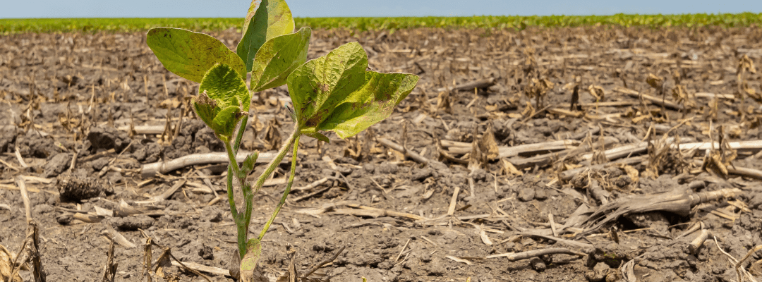
In the Eye of the Storm: Detecting Crop Stress
Early insight into crop health changes can result in faster mitigation – and detect signs of stress before they come severe. Using vegetative indices like NDVI can offer insight into plant-level performance, but also provide broader indication of what’s happening across the field.

NDVI measures chlorophyll levels in plants, and as a plant becomes more stressed – these levels decrease. This provides insight into the “what” – plants are not healthy – it often doesn’t tell you the “why,” which can be more of a challenge to derive.
However, remote sensing unlocks the ability to leverage other data points to help with this. By using aerial imagery, you can get a clear picture of the field to see what may be occurring. These images can also be translated into detailed data analytics via data science, meaning that you can get an indication of how the stress is impacting the overall vigor and growth of the plant. Measuring crop height, for instance, can give an indication of whether a weather event stunted growth.
NDVI can also indicate if a broad swath of the field is experiencing stress, which may be linked back to broader water issues within the field – like drought. As mentioned previously, understanding how water flows within the field can give early indication in areas that may be more stressed with drier weather; and help inform ideal irrigation strategies.
At the crux of all of this is tying it back to weather data – which helps to inform what happened and when; and often times, that will inform the “why.” Crops are not only stressed by weather events; they face disease, pests, and weeds – all of which can cause additional issues with crops. Often times, the severity of these issues are guided by weather, as well.
Using an agronomic insights platform like FieldAgent can give insight into weather at a particular field location, while offering Notifications for specific weather events – like hail or frost.
After the Event: Assessing the Damage
After an unfortunate weather event, now comes the challenging part – assessing the damage and knowing what happened within the field. There are a few ways that remote sensing technology can help indicate the level of impact from a weather event.
Using satellite imagery, it can help give an indication into which parts of the fields were damaged. Aerial imagery, particularly when you use a ultra-high-aerial resolution sensor, can give more accurate insight into which areas of the field were damaged and help to inform insurance claims and other areas of financial assistance.
Now, what we know with some of these weather and climate events is that they are more gradual and impacting crop health and stress over time (like droughts). While remote sensing can give that end-view into the areas that were impacted negatively due to the weather and climate issues, it can also create a record of how it progressed throughout the season.
This can be helpful in two ways. For one, when assessing the extent of the damage, it can help to record the changes throughout the season and how the damage may have progressed.
It can also create a story for the season that can be leveraged in the future for reviewing year-over-year trends, and understanding how shifting weather patterns may impact specific areas of a field. And, with this level of information, it can start to inform an agronomic model – to help give deeper insight into how variables impact crop performance, from emergence to maturity and every stage in between.
The Future of Remote Sensing and Weather Events in Agriculture
One thing’s for sure: the weather is going to continue to be unpredictable and create challenges for the agricultural industry. Recent years have shown us an increase in weather and climate-related events, and the damages from these events have continued to climb.
Using technology like remote sensing can help prepare the field for the challenges that changing weather patterns are bringing to agronomic leaders; but it can also help to inform what’s happening on the field throughout the season to help detect changes in plant stress, helping to create immediate mitigation strategies.
And, when it comes to understanding what happens in a weather or climate event, remote sensing can play a role there too – helping to provide accurate insight into areas that may be impacted, and what that means for insurance claims and other areas of financial assistance.
The drive to increase food productivity while battling changing weather patterns and climate changes creates a unique challenge for our industry – but, by leveraging technology and analytics, we can continue to persevere and demonstrate continued resiliency in managing the unpredictability that we face, season after season.
 , for deeper insight.