When it comes to collecting the precise data you need to take your plot trials to the next level, there are a few things to consider. Precision refers to the accuracy of each measurement, of course, but in order to obtain a truly accurate understanding of your plot trial, you also need those measurements to be taken with as much frequency as you can manage.
After all, being able to measure the difference between Day 20 and Day 22 is considerably more valuable than comparing Day 3 to Day 30, right?
But increasing the data collection frequency of measurements can be a real challenge if you’re still relying on the same manual methods that have historically been used. How many hours does it take to walk your fields to collect those measurements? How long does it take to input all that data? You might have time to devote to this when things are slow, but when, for example, those soybeans begin flowering, you need that data now – and, ideally, you need to be able to compare it to the measurements you have for those same plants from a day or two ago.
And even once you have your data, there’s the matter of accuracy. You’re not getting data on every single plant when that information is being collected manually; it’s just not feasible for a person to count and record every single plant.
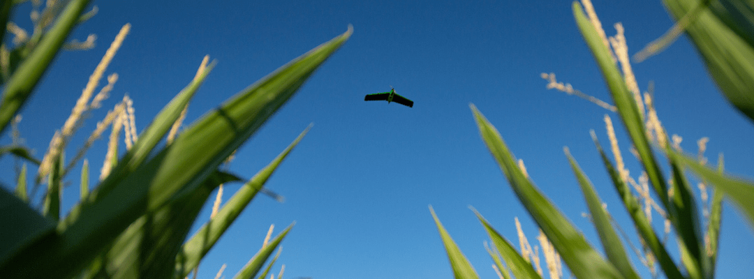
But with drones and sensors, it’s not only feasible – it’s simple to collect, organize, and use data just as frequently as you’d like. Whether you’re flying your fields daily to quantify the shape of a canopy curve or doing it every few days, drone technology gives you 100% field coverage, collects all the data points you need, and technology empowers you to do it much faster compared to manual methods.
As an added bonus, that data is automatically stored within the images and can be accessed immediately, next week, or in 10 years – whenever you need it, it’ll be there.
More Frequent Measurements in Less Time
There’s no denying that data collection can require a massive time commitment. In fact, the amount of time it takes to collect a field’s data, whether it’s set up for plot trials or designed for broadacre crops, is often the primary reason why researchers and seed developers don’t take measurements as frequently as they’d like—they simply don’t have the bandwidth to keep getting out there.
If you could collect that same data (or even more better data with more accurate measurements) in, say, 25% less time, would that change your approach? Because that’s the kind of time savings you can expect, right off the bat, when switching from manual collection methods to using drones and sensors to capture aerial imagery. And if that’s still taking too much of your time, there’s good news—you can enlist flight services to handle the actual flying and collection for you, so you can spend your time doing the work you need to focus on.
Over the course of a season, measuring growth a few times will give you some helpful information, sure—but getting a snapshot of that field from four different dates doesn’t give you anywhere near the insight you’d get if you had measurements of the same plants every day or two, especially during key growth stages. The increased data collection frequency itself becomes a core piece of information gleaned from the trial, allowing you to see nuances that would otherwise be missed—nuances that could impact how you set up your next plot trial, how you market a product, or what changes you make next year.
Leveraging Aerial Imagery to Increase Data Collection Frequency
Even better than increasing data collection frequency, is the fact that when your data is coming from aerial imagery, it’s objective and repeatable. You can set your drone to fly the exact same pattern, the same time of day, and capture the same measurements all season long, as often as you want, enabling you to do a true apples-to-apples (err, corn-to-corn?) comparison of plants and plots over time.
Plus, because drones designed for this purpose pair seamlessly with software designed to store, sort, and analyze the data collected, the post-collection process is also sped up in a big way. Data is only valuable when you can actually use it, right? So more data isn’t inherently better, but it’s inarguably beneficial to research when it’s easy to analyze, both now and in the future.
And that’s another exciting example of the benefits of aerial imagery. Today, you might not be terribly interested in how a specific measurement changes from one day (or week) to the next, but what about later? What if, in five or 10 years, this plot trial is still going strong and you find that a particular trait addresses an issue you hadn’t anticipated? Or, what if a trait that wasn’t appealing for this particular plot trial may have a use for a different research purpose?
Having frequently captured data from previous years available to you at the touch of a button (more or less) could be an absolute game changer for your future research—and since, with drones and sensors, you don’t actually have to put any additional time or effort into capturing those measurements, you’re setting your future research up for true success.
When you don’t have to work harder or invest more time to get more frequent measurements, there’s really no downside to collecting them on a regular basis.
And remember, the samples you’re growing today, right now, will never provide quite the same measurements and data again, so now is the time to start flying. By the time the next season rolls around and you’ve got more data to slice and dice, you’ll be glad you didn’t wait.
 .
.