When it comes to water in agriculture, it often times feel like a throwback to Goldilocks – getting it just right makes all the difference to optimize crop yields. Unstable crop yields can be caused by too much water, and as experienced in the recent season, not enough.
Using aerial imagery to capture elevation characteristics of acreage delivers essential insights to understand how topography changes may impact crop growth throughout the season. And, pairing it with hydrology insights can give deeper indication of water flow and impact on crop health.
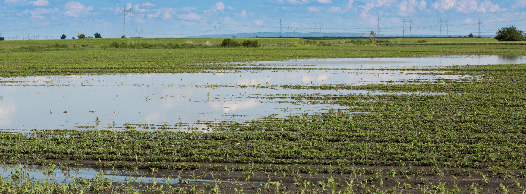
Elevation and Hydrology Analytics Overview
Aerial imagery via drone technology is a valuable tool for capturing insights about elevation and hydrology. It can be used to create digital surface models (DSMs) to calculate a variety of hydrological parameters, such as slope, aspect, flow direction, and flow accumulation. These parameters can then be used to model water flow and flooding, design drainage systems, and assess the impacts of land use change on hydrology.
The Elevation and Hydrology analytics offered by Sentera delivers a suite of data to give deeper insight into the bare soil elevation and hydrology characteristics.
Captured prior to crop planting or after crop harvest, the Elevation and Hydrology analytics provides elevation contours, hydrological flow lines, and ponding areas.
How to Use Elevation and Hydrology Data
From mapping elevation within specific fields and getting insight into how water flows within an area, Elevation and Hydrology Analytics can offer essential insight into planting and input management strategies. It can also help inform key decisions around erosion control.
Some other uses for elevation and hydrology data include:
- Flood risk mapping: DSMs can be used to identify areas that are at risk of flooding during heavy rainfall events. This information can be used to develop flood warning systems and evacuation plans.
- Drought monitoring: Aerial imagery can be used to monitor changes in water levels in lakes and reservoirs. This information can be used to identify areas that are at risk of drought and to develop water conservation measures.
- Watershed management: DSMs and aerial imagery can be used to model water flow and sediment transport in watersheds. This information can be used to design drainage systems, reduce erosion, and protect water quality.
- Wetland restoration: Aerial imagery can be used to identify and map wetlands. This information can be used to plan and implement wetland restoration projects.
Elevation and Hydrology Analytics: What’s Included
The Elevation and Hydrology Analytics from Sentera starts with a RGB mosaic, which provides a bird’s eye view of the field. The elevation digital surface model (DSM) single-band mosaic shows the elevation of the land. Typically, DSMs are represented as a grid of pixels – which each pixel representing the elevation of the land surface at that point.
")
Because of this, they can be used to create detailed and accurate maps of the land surface.
In addition to the mosaic and DSM, Sentera’s analytics also include elevation contours at break intervals, flow lines, and ponding areas for deeper insight.
How to Capture Elevation and Hydrology Analytics
To capture aerial imagery for the Elevation and Hydrology analytics from Sentera, drones must be flown in the off season – either at the end of the season or prior to planting in the spring.
Sentera’s Elevation and Hydrology analytics can be captured via Sentera’s ultra-high-resolution aerial imager, the 65R, which is compatible with the DJI Mavic 300 and the Freefly Astro.
In addition, imagery captured by the Phantom 4 Pro and Phantom 4 RTK, Mavic 3 Enterprise, and the Zenmuse X4S, X5S and P1 can be translated via Sentera’s advanced data science ecosystem into Elevation & Hydrology analytics.
 to see how Elevation and Hydrology analytics may work for your use case.