Productivity growth in agriculture goes beyond doing more with less – it has a significant impact on the world’s food supply; helping to deliver more food throughout the world. And, as we look at our finite farmland with our growing population, finding ways to accelerate crop performance serves as essential for our future world.
Plant performance analytics provide detailed insight into how crops are performing within the field, and that provides an essential layer of information. But what if we could gather more insight that goes beyond how our crops are performing? What if there are detailed data sets that provide measurements into the field – and how soil health and water supply may be impacting crop health throughout the season?
Leveraging ag technologies (like drones and sensors) help pick up key indicators on can power critical agronomic decisions and validate outcomes. Did you know that this goes beyond evaluating how crops are performing throughout the season?
Optimize Soil Management with Residue Cover
Soil is arguably the most important factor when it comes to crop and plant performance – understanding which nutrients are available, as well as how fertilizers and other inputs perform, are critical to maximizing outcomes throughout the season. So how can you better understand what and why behind what’s occurring in your plot or field? Aerial imagery plays a vital role in picking up on these key plant performance analytics – like evaluating residue cover.
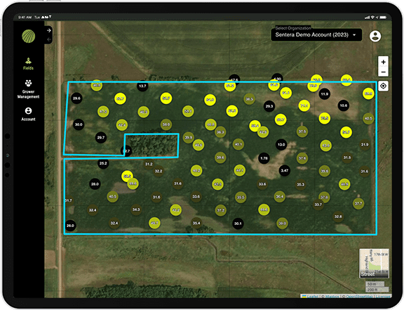
Example of Residue Cover
Prior to the season beginning, ag drone technology can capture high-resolution aerial imagery to give an indication of how much residue covers bare soil. By quantifying the amount of residue cover, it can help give an indication on how to manage soil for the season to come. This includes determining your tillage strategy, as well as how it may impact planting.
By taking a look at soil quality and health prior to the season beginning, or even after the season ends, it can give an indication of soil health. As the core of what drives plant health throughout the season, understanding how to best manage this throughout the season can be instrumental to maximizing yield and key outcomes. Insight into residue cover can give an indication on how to manage erosion, conserve soil moisture, improve overall soil structure, and build and store soil organic matter.
So, how does drone technology pick up on these indicators? By sensing and recording reflective radiation to assess the soil. Sensors like the Double 4K and 6X capture the multispectral imagery needed to pick up the key insights that can give insight into residue cover in the off season. By going beyond what can be seen with the naked eye, these ag drone sensors are able to dive deeper into plant performance analytics – fueling more efficient and precise agronomic decisions and insights.
Mapping Your Field with Plant Performance Analytics: Crop Area
Looking to gain an understanding of exactly where your field begins and ends? Understanding the borders of your field or plot directly impacts agronomic decisions by informing things like where to plant, spray, or apply other key insights, and get more detailed knowledge of what is changing in and around the field.
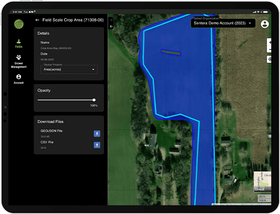
Example of Crop Area
Crop Area serves as an analytic that digitally tracks your field or plots borders – helping to limit drift, track wind damage, and more.
Limiting drift is specifically resourceful for seed production as it minimizes the risk of genetic drift. It can even tie in with practicing more sustainable agriculture as it can help to decrease risk of fertilizer application polluting water or migrating to other fields, among other issues associated with chemical drift.
The insights provided by plant performance analytics give a more accurate picture of what is needed in terms of resources – and with higher costs and fewer supplies this is extremely beneficial. By knowing the exact dimensions of your field or plot you’re able to make precise calls on how much fertilizer to use or how much seed to plant, saving you both time and money.
The ability to track field borders digitally boosts workflow efficiency by allowing you to process 10x more fields in half the time it normally takes. Crop Area also assists in practicing regulatory compliance by ensuring you are working within your field or plots limits and avoiding misguided practices.
Elevation & Hydrology: Getting a Lay of the Land
Each field and plot come with unique shapes and sizes – which plays a significant role in their performance. An areas topography can drastically impact:
- Water management, response to rainfall in terms of waterflow and storage
- Plant growth, indicating where to plant and problem areas
- Soil condition, pinpointing what areas are susceptible to varying soils
Flying plots and fields with ag drone technology serves as a vital tool to detect variations. Aerial imagery pinpoints specific areas in need of repair faster and more accurately than boots-on-the-ground alternatives. Specific tools like evaluating elevation within a field area, as well as how water flows within the area, further improves picking up on key plant performance analytics that impact field and plot performance.
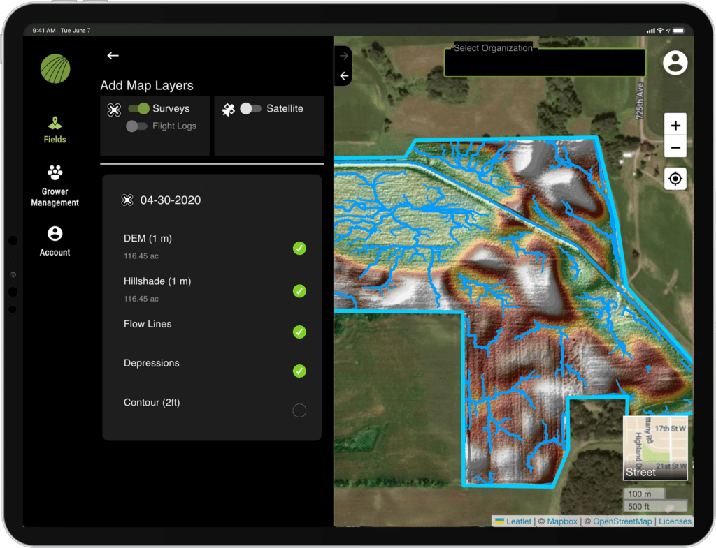
Example of Elevation and Hydrology
As an analytic, Elevation and Hydrology measurements work to capture views that are typically more difficult to get, giving you a clearer understanding of what is happening across your field or plot. Specifically, you’re able to see and understand how water will flow within your field – allowing you to adopt water management practices. This directly assists in avoiding flooding, run off, and even areas not obtaining enough water.
By understanding water flow and soil conditions, Elevation and Hydrology analytics help to fuel critical agronomic decisions like where to plant, where to avoid, and potential solutions. Instead of planting the same across the field or plot, you’re able to improve your crop yield and health by making informed decisions; avoiding wasting time, money, and resources planting in problem areas.
Crucial insights that can boost productivity go beyond just crop health. Yes, crop health is a powerful tool in assisting decision-making throughout the growing season, but there are many other critical indicators to leverage that promote productivity, efficiency, and fuel agronomic decisions.
Gaining insights from Residue Cover, Crop Area, and Elevation & Hydrology allow you to make informed agronomic decisions more efficiently while optimizing yield and minimizing costs and time spent.
 eBook provides an in-depth look into uncovering the data and insights needed for high performance characterization analytics.