Geographic Information Systems (GIS), which are designed to showcase how data syncs with geographic information, can be dated back to the 1850s; however, it was first predominantly utilized for physical mapping. Conversion to the digital world began in the 1960s and opened the door for many pioneers to discover and innovate ways to apply fast-growing technology.
Today, GIS is crucial for many industrial sectors such as utilities, urban planning, telecommunications, government, and many others – including agriculture.
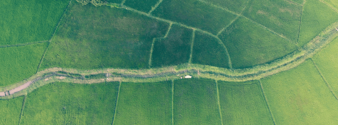
The large industry of agriculture has adopted GIS as a viable technology to inform farming practices and operations. Within agronomy, this includes mapping data back to fields to get an understanding of soil health, crop performance, and even how certain risks – like pests, diseases, and weeds – are impacting crop health and yields.
While agriculture may not have been the first industry association with GIS, it has proven its value within the industry.
How Does GIS Fit into Agriculture?
Agriculture faces unique challenges, mostly due to how unpredictable industry can be, which poses a variety of questions. When will be the ideal time to plant, given current weather conditions? Will there be an influx of weeds in these fields this year? Are there pests or other diseases that I should be aware of? Do I need to think about soil health and how it impacts my crop’s performance? What will my yields look like?
The questions go on and on. Because GIS can provide answers and solutions to many of the hardest challenges facing our industry, the value of GIS in agriculture speaks for itself.
Beyond that, GIS helps in the ever-ending question to find tools and technologies that allow us to do more with less, which is essentially its role in agriculture. This tool can be used to create in-depth maps that highlight soil type, field analytics, and crop health insights, faster and without sacrificing data quality.
While it can stand alone, GIS provides even more value in combination with other key solutions, like remote sensing, computer science, and other spatial data. As a result, GIS provides quantitative information that can be analyzed by agronomists, researchers, and leaders in agriscience. Digital analysis provides the opportunity to do a wide-range investigation from individual plant to field scale evaluation quicker and without manual in-field labor. Though manual in-field surveying remains a common practice (and will never go away), remote analysis can provide information about crop qualities outside the capability of the human eye. In addition to efficiencies in time, managing data through databases and GIS end-users can visually compare numerous locations simultaneously.
Key Use Cases of GIS in Agriculture
At a very basic level, GIS can provide spatial data. This means that it can provide insight into field locations and boundaries, and when layered with other data, it can offer deeper analysis – and give insight into why things are performing a certain way.
For instance, by layering on weather information (like the number of growing degree days), it can give an indication of when emergence should occur within a field. Using satellite data to generate key vegetative indices like NDVI or NDRE, it can help provide an indication of crop health and performance throughout the season.
However, where GIS really shines is when you combine it with aerial imagery and data science. Drone technology serves as a cornerstone for precision ag, providing an easy-to-launch method to capture imagery for large areas (think entire fields!) in a fraction of the time it would take to scout in a few areas.
Taking this and feeding it into a data science ecosystem, like what powers Sentera’s FieldInsights analytics, GIS can translate outputs generated by machine learning algorithms into powerful and easily understandable results, including:
- Stand Count
- Plot Trial Crop Health Ratings
- Field Scale Canopy Cover
This data can also be leveraged to help inform replant decisions, as well as how to manage key inputs – like herbicides and pesticides – within a tight time window. Because of the speed to insight when combined with data science, GIS technology can be extremely impactful with the ability to reduce wait time.
And just because the decisions need to be made quickly, does not mean that reliability and quality are thrown out the window. GIS accelerates the workflow and ensures that you are getting high-quality data along the way. Decisions based on quantitative data analysis can remove uncertainty, human-error and bias, while enabling streamlined follow up actions.
Accurate Analytics: The True Benefit of GIS in Agriculture
Data quality can essentially make or break reliability. When you’re relying on primarily manual data capture and analysis, you are opening the door for subjectivity in your data. This isn’t done on purpose or something you can avoid; sometimes it comes down to strictly human error.
Tools like GIS are meant to improve data quality so that you are making well-informed decisions and validating outcomes with certainty. It is a technology that relies on a machine; it eliminates subjectivity and human error, meaning that accuracy comes as standard. When it is used with remote sensing and machine learning technologies, you’re eliminating human bias and minimizing the variability within the data – all while being able to generate more measurements for analysis.
Not only does GIS deliver more quality data, but it also optimizes efficiency and timeliness in the precision agriculture world. Without needing to source manual labor for data capture (providing a solution to the labor shortage!) and using advanced technology to evaluate large volumes of highly accurate spatial data in a useful way, operations can be managed more efficiently and effectively.
And we know that speed to insight matters – especially when in-season decisions hinge on what may be captured via remote sensing technology. Combining GIS with a data science ecosystem means that aerial imagery data can be translated into measurements and delivered fast enough to make the decisions that help to maximize the season ahead and validate key outcomes for research and product development.
Much like we’ve seen with GIS in other industries, there’s an opportunity for this technology to continue to grow and pave its way. The future impact of GIS will continue to evolve in a positive manner; it will help the industry continue to do more with less, without sacrificing the data quality along the way.
 to learn more about available technologies to optimize data capture.