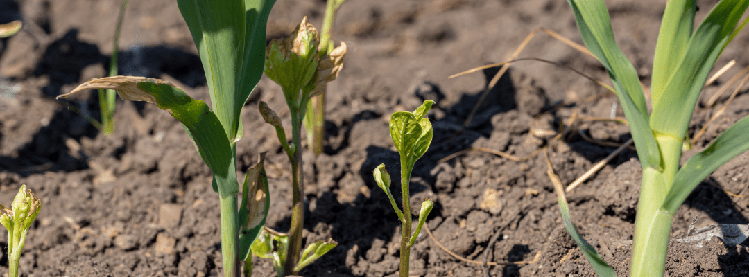
Weeds are never fun to deal with, but 2023 is sending early signals of an especially tough year for weed control. Predictions for dry weather with broad areas forecasting drought-related challenges similar to 2022. If that happens, just like 2022, we are likely to see conditions that favor weed growth.
On top of the environmental risk sits concern about the availability of crop protection products. It is the perfect storm – accelerating the weed problem and making weed control more difficult. These aren’t the only issues at the top of the minds of growers and the crop protection industry; there are also the challenges that come with weeds growing resistant to certain herbicides. This leads to having to use even more expensive and specialized herbicides – which require a different management strategy to ensure every drop matters.
On average, weeds reduce yield by 28% if they are not properly controlled. From growers to researchers to seed producers, this has an impact on profitability and, on a larger scale, puts a wedge in our efforts toward food security. This forces everyone to scramble for efficient, effective, and inexpensive solutions to ensure higher yields by combatting weeds.
Finding a Solution to Controlled Herbicide Application
While there is no magical cure for weeds, there are a variety of solutions that assist in controlling them. Remote sensing and on-field machinery pair for efficient and accurate data capture and analysis that assist in making decisions crucial for precision herbicide application.
When looking at more manual methods, there is a sense of subjectivity in the data being collected due to human error. And add onto that the time commitment and limited labor force in agriculture right now; it isn’t an efficient way of gaining insight into field performance.
Ag drones have been adopted to augment manual protocols and methods in many sectors of agriculture, from scouting to input application. They become more and more prevalent each year (in fact, the Association for Unmanned Vehicle Systems International (AUVSI) projects that agriculture will account for 80% of the global commercial drone market.). But what does this have to do with weed control? By providing an “eye in the sky,” you’re able to gain a bigger picture of exactly what is going on in your field, and this 100% coverage is done significantly faster than manual methods.
Drone technology and machine learning can pinpoint where a weed is, what type of weed it is, and assist in deciding how to treat it. By leveraging an ag drone and sensor to capture accurate and precise data, faster, you’re able to make more reliable and timely decisions.
Perhaps the most understated value that ag drone systems bring to the fight against weeds is the ease of use – mostly because the equipment isn’t unwieldy or cost prohibitive. While some may not be interested in becoming a drone pilot, there are alternative options where others do the flying to capture the data.
The evolution of ag drone sensors has further advanced how precise and accurate data capture is. Like new advanced ultra-high-resolution sensors that offer a previously unmatched bird’s eye view of what’s happening at the field level, helping to identify weeds as close to emergence as possible. Used with other technology that focuses on using geolocation technology for accuracy in where weeds may be sprouting creates a solution that makes the quest for identifying a quarter-inch weed more possible than ever.
The advances don’t stop there – leveraging a data science ecosystem powered by machine learning translates the data into actionable insights. While a picture is worth a thousand words, when you’re tying actions back to what you’re learning, having raw data goes much further. In doing so, the algorithm reveals the type(s) of weeds, where they are, and helps to inform the next steps.
The Outcomes of Optimizing Herbicide Application
Limiting and better controlling herbicide use leads to a wide range of advantages across the spectrum, from saving costs financially to providing a more sustainable solution.
With increasing prices for nearly every herbicide, there is this heightened risk for substantial financial loss. With the help of ag drone systems, aerial imagery captures exactly where and what needs to be treated. Instead of just spraying an entire field with this expensive input and hoping for the best, you’re able to guide application and ensure you’re not wasting tons of products. So, even for the everyday farmer, leveraging this precision agriculture technology drastically cut costs while boosting outputs.
And limiting waste by targeting areas in need doesn’t just lead to a monetary reward; it also limits agriculture’s environmental impact. When a whole field is being sprayed with chemicals, there is a giant risk of chemical drift contaminating nearby water supplies, fields, residential areas, and other surrounding areas. This causes a huge concern, especially as we begin experiencing the impacts of climate change and are striving for a more eco-friendly and sustainable future.
By leveraging these technologies, weed control as we know it will never be the same. We need these latest innovations to continue to solve problems (like weeds) that we face year after year. As the drive for a more sustainable future for our growing population continues, having efficient and effective solutions to the various challenges facing agriculture is a step in the right direction.
 to learn more.