From optimizing growers’ productivity to assisting in ag research efforts, drone technology offers several benefits in various situations. Collecting research-grade data requires precise and reliable methods. In fact, ag drone systems provide accuracy more efficiently, with data collected 25% faster than manual data capture. A faster and more abundant data collection method has become more enticing with the struggles accompanying labor shortages.
Besides collecting data faster, drones also reduce the likelihood of human error while collecting more data. This allows for consistent data collection and reporting, eliminating data variability by removing key variants – like cloud cover – that could impact measurements. Because drones act as an eye in the sky, by translating high-resolution imagery into detailed data sets, researchers can garner access to 10x more measurements. This results in further validation for key outcomes and providing the supplemental data they never knew they needed.
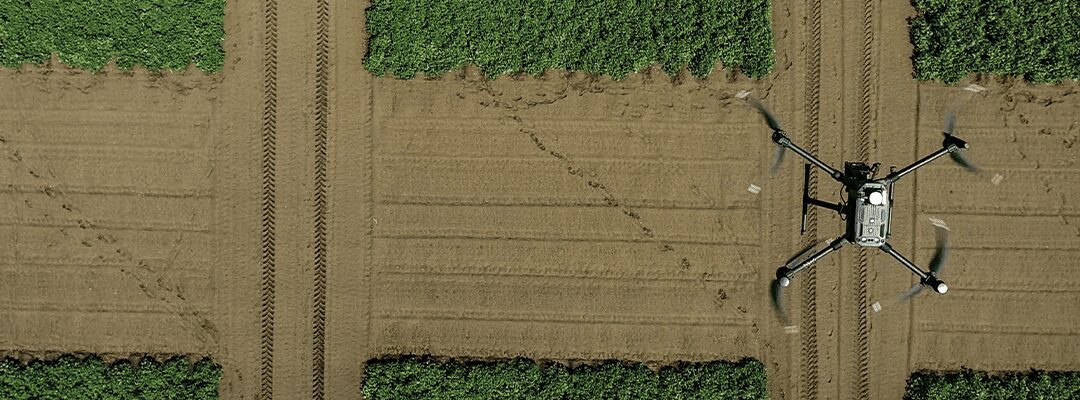
Image and spectral-based methods provide a new approach to augmenting or replacing existing data collection protocols. With clear, precise imaging, ag researchers can better understand crop performance. When deployed on an unmanned aerial vehicle (UAV) platform, these new sensors are designed to reduce field-edge data capture time per plot and unblock logistical constraints on the frequency and coverage of measurements.
Ag drone systems and sensors can assist agronomists at every level, providing the tools for precise data capture and analysis.
Take-Off: Getting Started
While these methods provide a scalable approach, it may take some practice and training before feeling confident in their reliability and precision. Trusting in a new protocol can be challenging, particularly when so much is on the line. What if there is erroneous data? What if the data isn’t captured as noted? There are a significant number of detrimental mishaps that could occur, so selecting a consistently trustworthy method is crucial in these dire research situations.
However, as with any new measurement protocol, diligent implementation will ensure successful outcomes. Ag drone use begins with coordination, ensuring you have the necessary support and materials.
First, start by uncovering your goals for the flight. This question is critical not only for the data you will be seeking but also for the tools that will be best to accomplish your goals. Identifying your use case and building out your plan assists in pinpointing your flight schedule. Thinking of what growth stage will be best for the data you need narrows down the time in season; finding optimal weather conditions can harrow in on a specific day and time.
While coordinating flight plans, ensure you have a properly trained pilot. To fly your drone, you must have proper training. If you are uninterested in flying the drone, services are available to do the flying for you. For instance, our Flight Services team allows researchers to take advantage of over 250 trained pilots worldwide. This allows you to use fewer resources and time, allowing for your focus to be on making critical agronomic decisions.
Airborne: Collecting the Data that is Right for You
Conducting ag research can be challenging with all the unknown factors influencing trial performance. But, having a controlled source of data collection with additional measurements adds some predictability, helping to reduce these unknown and inaccurate factors. Selecting the right drone technology for your needs offers efficient and precise data capture that limits data variation and discrepancies.
Collecting in-season measurements at the right growth stage requires diligent effort and a negligible margin for error. Collecting this data early allows for more accurate and immediate decision-making to adjust inputs, treatments, and general methods to better the crop. This is where high-quality imagery becomes especially beneficial. Thus, selecting the right sensor can build on the images’ clarity.
The crops you are researching play a significant role in determining methods, resources, and equipment to capture visual components. The Normalized Difference Vegetation Index (NDVI) and Normalized Difference Red Edge (NDRE) are two of the most popular crop indices. NDVI is a reliable indicator for crop health, where the NDRE picks up on vegetative stress early on. Each of these offers their own set of benefits and can be used throughout the season to get the first indication of crop health – with more detailed analytics available to dig into specifics, like monitoring flowering development or tracking canopy cover.
Just Landed: Applying the Data
Before you or your pilot packs up and leaves, ensure that the data is captured correctly and in the manner you need. This can be as easy as taking the SD card out of the sensor and plugging it into a laptop, transferring the images immediately to begin processing.
Even so, now that the data is collected, what do you do with it? After data capture is completed at the field edge, analysis can begin back in the lab or office. The information gathered during a drone’s flight can power critical decision-making at any point in the crop’s lifecycle.
For instance, in-season data is utilized to make decisions that:
- Optimize inputs, like knowing how much fertilizer to apply
- Track performance, such as comparing growth metrics week over week or across locations
- Manage risk, by getting the first indication when things start going awry, so issues are mitigated early and quickly
Beyond the season, data collected by ag drone systems can be validated after the season, like:
- Understanding crop performance, such as which genetic traits may be ideal for research and product development goals
- Uncovering supplemental proof points, like how to further support outcome validation by providing more data insights
- Selecting genotypes for future development, by leveraging full data sets to make selection decisions
Data analysis can take many different routes when you are leveraging high-resolution imagery. For one, there’s the opportunity to use the images themselves to come to conclusions – especially when using ag drone sensors built for precision. These images can provide insight into what’s happening within the field. These can also serve as a basis for NDVI and NDRE imagery, indicating crop health and performance.
Translating high-resolution aerial imagery into detailed analytics and data sets brings more value to researchers. This is where more data is uncovered without sacrificing precision or accuracy. In translating these images into numerical data sets, researchers can uncover essential insights, like Stand count uniformity and row fill early in the season
- Vegetative health, looking at metrics like canopy cover, flowering, and height and lodging
- Weed detection, resulting in understanding which weeds are growing where, as well as the pressure and resulting treatment options
- Field management and performance, reviewing data around residue cover, crop area, and elevation/hydrology
- Corn tassel growth measurements (or tracking the accuracy of detasseling operations)
These data sets can be reviewed in several ways to fit research goals and processes. They can be viewed in a software ag platform like FieldAgent, which makes it easy to view, report, and analyze key data sets. From there, they can be exported in a format of choice for further analysis. Lastly, API integrations can push the data into a preferred solution.
No matter your research goals, building ag drone technology into your process serves several benefits. On the front end, it helps to reduce the need for labor while saving time for data collection. Throughout the process, it augments data accuracy and precision while delivering detailed insights that fuel decision-making – validating ag research outcomes or supporting an accelerated product development lifecycle.
 to get more insight into how ag drone technology supports the research and development lifecycle.