If you’ve ever flown in a plane, you know how thrilling takeoff can be – and the same goes with drones. Drone launch can be one of the most exciting (and important) parts of flight. And though it can seem a little intimidating, it doesn’t have to be.
But how do you prepare for a successful flight? How much pre-planning needs to be done to ensure a successful launch? What do you do after the drone is launched?
To ensure your launch goes smoothly, we want to provide some tips and tricks to make your flight a little easier.
Pre-Flight Planning: Goals, Gear, and Guaranteed Drone Launch Success
Ensuring that you have a successful drone launch begins before the day of the flight. There is a need for pre-flight planning to ensure that the flight is successful. So, while thinking about your mission here are some important questions to ask yourself:
- What data or answers are you looking for?
- What are your biggest concerns?
- Do you have and understand the correct equipment?
- What time of year can you find what you’re seeking?
Once you have the answers to these questions, you can begin mapping out the specifics for your personalized flight plan. After getting a deeper understanding of the “how” and “why” behind your mission, you can dive into the “what” and “when.”
Taking time to understand the capabilities of your equipment is a critical step in flight planning. With certain sensors specializing in different times of the year and drones’ differing maintenance, operation, and compatibility, you want to ensure you’re using them at the right times and correctly. Which is where our ‘23 Ag Drones and Sensors Buyer’s Guide steps in to provide specifications for different ag drone hardware pieces.
And when breaking down ideal flight conditions and when you should fly, it comes down to what to avoid when planning your flight. If we could simplify it to four main things to avoid, it would be:
- Precipitation, avoiding rain, snow, dew, and hail
- Fog, leading to data capture obstruction and potentially hazardous
- Scattered clouds, resulting in shadows
- Less than ideal time of day, avoiding two hours before sunrise and sunset
When you are flying in these inadequate conditions, you are risking data accuracy; as well as how smoothly your flight goes. When there are shadows being cast at different angles, you are risking the integrity of multispectral imagery specifically. These shadows are going to portray light differently in affected areas, causing variations in the data and how it is then analyzed.
And the same goes for both fog and precipitation, as they can both have a negative impact on not only the imagery being captured but can be hazardous for the equipment. Whether it be total obstruction of the image or skewing the data captured, neither are optimal for accurate and reliable data analysis.
Ready, Set, Go: Time for Drone Launch
The day of your flight is here! The forecast is ideal, the time of day is perfect, and it’s the right time of the year to capture what you’re looking for. But whether you prefer to plan in your office, home, or in the field – conditions are subject to change and there are variables to consider in the moments before and during flight. Let’s take a minute to look around and identify potential hazards or indicators of conditions changing and do any of the pre-flight planning that you prefer to do at the field-edge.
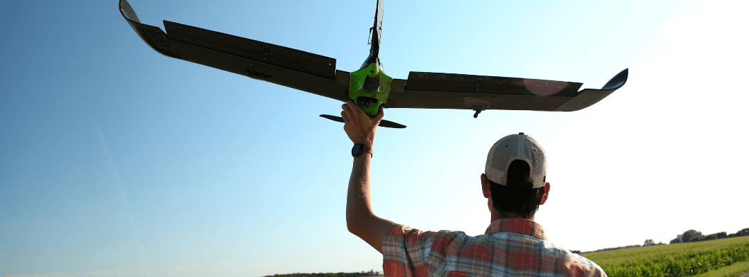
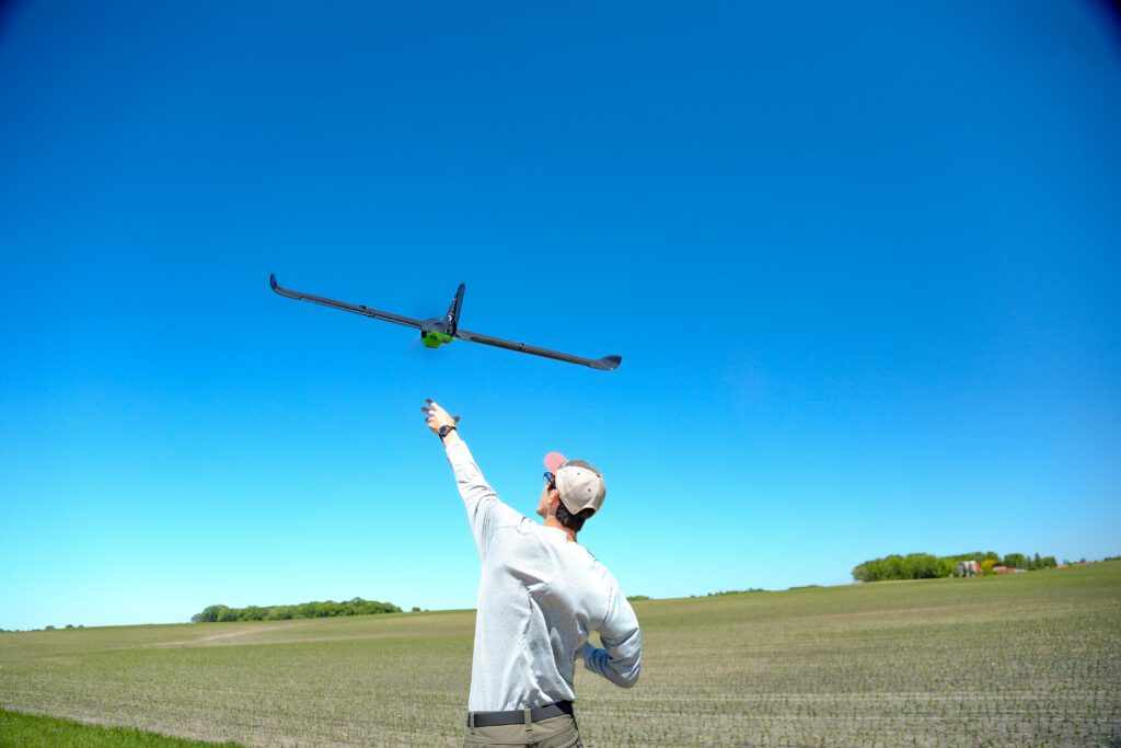
Between multirotor and fixed-wing drones, there are unique tips and tricks for a successful launch. So, let’s dig into launching the two types of drones.
First things first, look up. Often when launching a multirotor drone, we forget to check our surroundings – specifically for powerlines, trees, or anything else directly above where you intend to launch. This may seem redundant, but it is arguably the most common factor in multirotor launch crashes or failures. It’s all about that time of the drone leaving the ground and rising and just ensuring that there are no hazards or obstacles that could result in a failed launch.
And with fixed-wing drones, wind can be your friend. While you don’t necessarily need wind – when it is available, leverage it to your advantage. With fixed-wing drones, there is a specific speed the drone needs to reach for launch, whether it is through help from the wind or adding some momentum manually. Let’s say it’s a hot summer day with no wind, you will need to take a few steps while launching the drone to build some momentum behind the drone (and no you don’t need to go into a full sprint).
To build off of this, there is no need to throw the drone upwards. With fixed-wing drones, simply throwing them into the wind or getting that momentum to hit optimal airspeed will result in the drone climbing itself. Essentially, just remember to throw straight and into the wind, and if there is no wind, then add some movement to the throw to assist in reaching optimal airspeed.
In the Air: Getting into the Survey
You’ve successfully launched the drone, now what?
Similar to the statistics surrounding car accidents happening so close to home, the early drone launch and flight are the most prone to a drone crashing or flight failing. It isn’t necessarily guaranteed smooth sailing right after drone launch.
During the time it takes for a drone to get into survey, you have to monitor it to ensure no crash or failure. This first portion of the drone flight is going to be most prone to a crash or another issue occurring with the drone – making it vital to monitor it closely.
After this is over, sit back and relax – the drones have it from here on. Thanks to automated technology, there really isn’t much to worry about or do during the actual drone survey. So, take this time and spend it where it really matters: powering critical agronomic decisions.
 .
.