The season is right around the corner, are you prepared for it?
Failure to plan is a plan to fail. Regardless of your answer to the questions above, we can’t predict everything; unexpected things happen. But, having a plan in place – even if you must improvise along the way – allows you to be a few steps ahead. Forecasting the year can lead to a more successful and smoother year.
And, while this is true in life – the same can be said in agriculture. Yes, there are unprecedented factors, like weather, but there are things that you can forecast and plan for, especially when it comes to flying a drone to capture aerial imagery.
Pre-Flight Drone Plans: Goals and Gear
Planning a flight isn’t as simple as going out on a random day, at a random time – – there are many factors that play a role in a successful flight plan. Mission success really comes down to knowing what you want to accomplish:
- What data are you looking for?
- What answers do you need?
- What are your biggest concerns?
These questions help to lead the pre-flight planning by leading you to know which equipment you need, what part of the growing season you need to fly in, and where your attention should be directed. (All of which can go hand-in-hand with boots on the ground scouting.)
Once you have these questions answered and your flight goals in place, the next step is to spend some time to understand the capabilities of your ag drone system.
Start by assessing your sensor. Understand the type of data that it captures, as well as when it’ll be useful during the season. Some sensors can’t capture data late in the season due to how thick the canopy is, and they specialize in early season insights. Whereas others specialize in mid to late season crop growth and can pick up on later crop health indicators. This plays a key role in determining what stage of the growing season you will fly in.
Once you know your sensor, it’s time to get to know your drone. Learning the anatomy of the drone, like how to install batteries, SD cards, and sensors, serves as an important first step. For flight success, plan and take some time to assemble and disassemble the drone prior to hitting the field.
With your drone and sensor set, take some time to understand key flight parameters. At what altitude do you need to fly in order to capture the analytics you need? Are there certain parameters required in order to get the imagery for analysis?
Even with the best intentions and preparation, know that things will come up – not every flight is going to be seamless. But, with a plan in place and some advanced preparation prior to your flight, it can help to mitigate most problems; making it easier to tackle whatever roadblocks may come about.
3 Key Components: An Overview of Your Drone Flight Plan
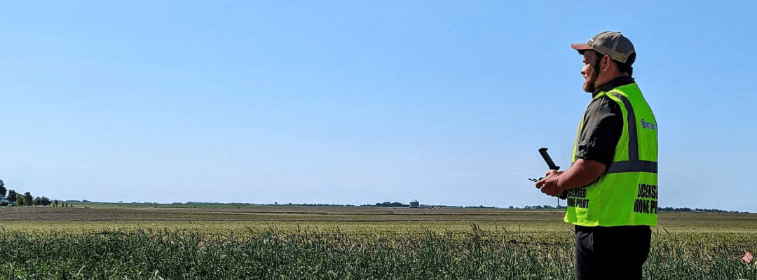
Takeoff is the start of your flight, potentially dictating how the rest of it goes. Before initiating the first step of your drone flight plan, it is crucial to note the wind, your surroundings, and be aware of every aspect of your drone system. If you are unaware of factors like wind or potentially hazardous surroundings, your flight can fail just as fast as it started. But a lot of takeoff has to do with pre-flight planning, so let’s dig into it.
Before a drone can leave the ground, there are quite a few factors to consider:
- What time of year is best for what I need?
- What’s the weather looking like? Windy?
- What time of day is best? (Avoid two hours before sunrise and sunset.)
- Is your battery charged?
- Do you have the correct attachments?
While there are other questions, these are significant to answer pre-takeoff to ensure it goes smoothly and you avoid challenges throughout the flight.
Data collection is arguably the most important part of flying. This is where pre-planning goals, gear, and good weather are most pertinent to the success of the flight. If you have the right system for your goals, this period should be smooth sailing.
This portion is typically an automated feature so if the flight settings are incorrect, it can be detrimental to the data you are collecting. Newer drones, like Sentera’s PHX fixed-wing drone, offer presets to select the data type you’re intending to collect – typically only failing when the incorrect sensor is attached. (Again, showing the importance of knowing your equipment!)
Landing your drone is similar to takeoff in the sense it has a lot to do with pre-planned patterns and being aware of surroundings. To avoid crashing or hitting things, it is essential to be aware of surroundings like trees, poles, and wires that could serve as an obstacle.
This is also a significant landmark in data collection success. Once you have landed your actual flight has concluded, transitioning you into the next steps: managing and analyzing the data collected.
And practice makes perfect, so after a few flights the whole flying thing will seem second nature to you. (No, really, it gets easier!)
Concluding Your Drone Flight Plan
You’ve landed and your data has been successfully collected – now what? The aerial imagery captured during your ag drone flight offers critical insights. So, leveraging ag drone software gives you a better, more efficient understanding of performance.
Translating your high-resolution imagery captured during your flight into FieldInsights empowers you with the analytics needed for making critical decisions. Using Sentera’s proprietary machine learning platform, this software turns the high-resolution imagery from FieldCapture and translates it into key analytics that make analysis and story-telling easier.
And taking these analytics from FieldInsights, FieldAgent offers deep visualization and reporting into plot performance and outcomes.
A successful mission isn’t just about collecting aerial imagery – it is finding solutions to your problems, accomplishing the goals for the mission, and ensuring you have the insights needed to back up your research. And this happens all the way from pre-flight planning to plugging in imagery to analyzing detailed anaytics in agronomic insights software.
