
2022 was compiled of content of all different forms to keep you in the loop of the happenings in the agriculture industry. From product launches to unique content to starting our newsletter – the Sentera Kernel – 2022 was filled with content-worthy topics.
With such a busy year, it’s hard to narrow down just a few of our favorite blog posts (but we may be biased). So, let’s dive into seven of your favorite blog posts this year based on engagement.
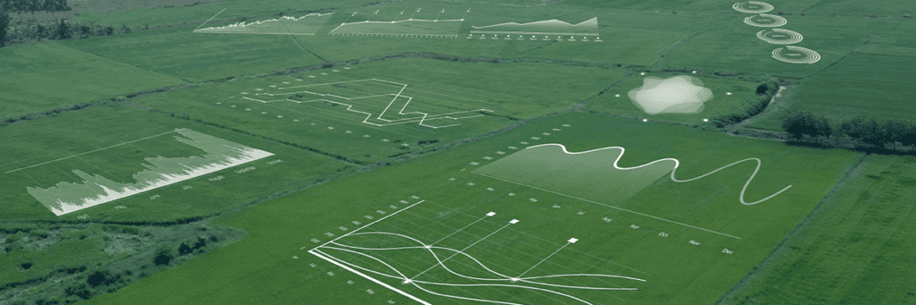
#7 Field Analysis: Performance Beyond Roots and Stalks
Towards the end of the season, it is crucial to begin assessing performance throughout the growing season. Did one area of your field perform worse than others? Was your yield what you expected it to be?
Well, a full field analysis will help indicate what you did right and wrong this year. Leveraging technology allows you to gain fast, precise intel on soil quality, water management, your field’s topography, and more. So, as we approach the 2023 growing season, this post may be just what you need to have a successful New Year.
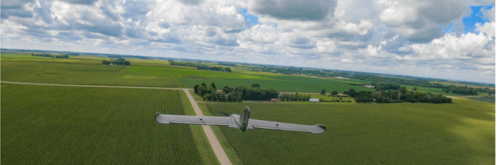
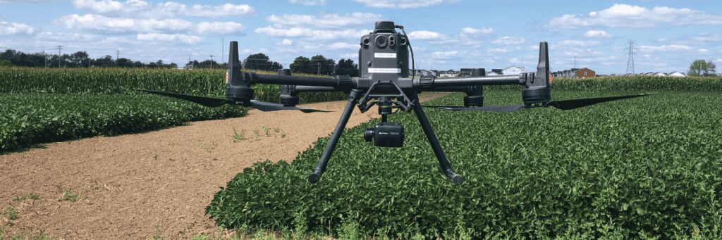
#6 Best of Both Worlds: Precision Landings with Fixed-wing Drones
With time being of the essence, faster and more accurate data collection gives you hours of your time back. Especially when capturing large-scale operations, ag drones with higher endurance, efficiency, and faster speeds are going to be preferred.
Fixed-wing drones offer productive advantages by providing longer battery life and double the speed of multirotor counterpart – thus higher endurance and efficiency. This doesn’t result in just saving time, you are also reducing costs and resources needed. Fixed-wing drones, like Sentera’s PHX, allow you to scout more acres and collect more data faster.
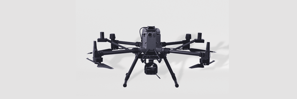
#5 Goodbye, Orthomosaic Maps and Hello, DGR System
Introducing Sentera’s DGR System and kicking stitching to the curb. The more traditional method for creating scaled maps is orthomosaic stitching; however, we know that this is an extensive process. The DGR System’s two main parts – the Dual Antenna RTK and tactical grade inertial measurement unit – team up to provide the most accurately scaled maps.
Sentera’s DGR System has transformed this process by reducing the project time by nearly 90%. This is due to reducing the number of images captured (lowering flight times) and eliminating the need for stitching processes. This allows you to access your data and analyze it at the field-edge.
#4 Satellite vs. Drone Imagery for Crop Health: What’s the Difference?
We often hear about both satellite and drone imagery being used for data collection. Each has their own specialties and are preferred in different situations. So, which should you choose?
Satellite imagery gives a more broadened view, where drone technology has the capability to be more detailed. Ag drone systems capture high-resolution aerial imagery that can be translated into detailed measurements and data sets. Though it is more precise, the two work together to fuel boots-on-the-ground scouting and making critical decisions.
#3 Will Drones Replace Airplanes in Agriculture?
Traditionally, when thinking about agricultural aviation you may think of airplanes right away. While they have been highly used, in the last decade or so we have begun seeing an increased use in ag drones. Do they have the capability to cut the need for airplanes?
Ag airplanes provide a more efficient option for covering more acres in less time, where drones are more focused on precision. As drones begin getting faster, withstanding longer flights, and gaining a more reliable reputation in the ag industry – it is definitely likely. What do you think, will ag drones beat out ag planes? Join the conversation on our blog post.
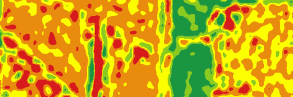
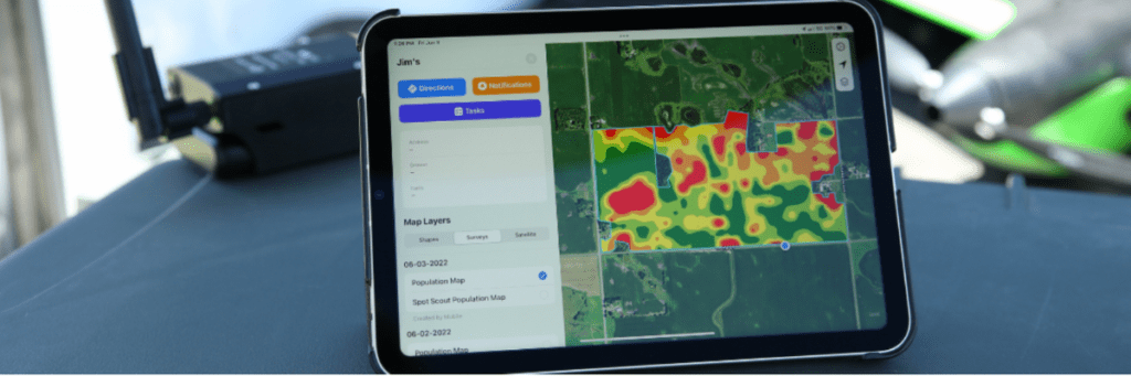
#2 NDVI vs. NDRE: What’s the Difference?
Two of our most popular crop index products are NDVI and NDRE (which is perfect that this topicalso extends to your favorites on our blog!). The two indices work best in different stages of crop growth and development. NDVI is more successful with less-dense canopies, meaning it works best early in the season. Then NDRE is the opposite and picks up the slack that NDVI leaves by measuring further down into the canopy. (We also have an infograph with further detail!)
Though they have unique capabilities and thrive in different parts of the season, they pair for optimal results. Where one falls short, the other shines – making the perfect duo for data capture throughout the entire season. This allows you to pick up indicators of crop performance through each growth cycle.
And our top performing blog post is…
#1 Radiometric Calibration: Eliminating Variability for Plot Trials
Comparing plot trial data over time can be challenging, as variability can degrade the data and make these comparisons unreliable. However, radiometric calibration provides researchers with the ability to trust in the accuracy of plot trial data.
Radiometric calibration removes the variability caused by different lighting and the density of clouds. Allowing you to make the upmost accurate comparisons over time, without worrying about how different conditions may sway results.
 .
.